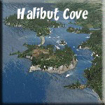
Destination: Halibut Cove
(Added: 07.11.2013)
Route Notes
- Suggested Altitude: 1200 feet but varies
- Landing zone is: Water, Tundra, Tarmac
- Aircraft: Amphibian or Heli
- GPS for destination: N58 35.83 W151 14.340
- Distance approximately:130 Miles
- Download PRINT-ABLE copy HERE
- Flight-Seeing Flight Plan HERE
- Trip Ticket FAQ Usage HERE*
- Scenery Needed:
* This Trip Ticket Follows the Flight-Seeing Plan
** no need to configure the plane panel, location only
Route Overview
FROM: Wasilla, AK (PAWS)
TO:
Halibut Cove, AK (PFXX)
We start off at the Misty Moorings Taxi Office at the Wasilla Airport. Using the FSX MAP feature, set your aircraft at:
Latitude: N61 34.38
Longitude: W149 33.04
Heading: 288
Altitude: 0
Speed: 0
This places you in front of the Misty Moorings Air Taxi Service building at the Wasilla Airport. We will be stopping at several USFS Cabins on our way to pick up and drop off passengers along the way to beautiful Halibut Cove. You can decide to land at the cabins or continue over them. Some are very difficult to "spot", but flying low and slow, (and carefully) you will see all of them. The gps route is "autopilot friendly" ... this means you can let the plane fly itself and read the narration (always in italics) and just enjoy the ride. Because you will be landing on several surfaces, tundra, water and tarmac, an amphibian would be the best aircraft selection.
NOTAM: You must change altitude for each leg manually. Each leg has a recommended altitude. Of course, if you are going to land, you must come down from that altitude to the landing zone.

Leg: From Wasilla PAWS to Elmendorf VOR (EDF) 110.3
Initial Course: 179*
Leg Distance: 20 miles
Leg Altitude: 1800 Feet
Leg GPS: PAWS-ELM
We leave Wasilla airport and fly on a rough heading of 179* toward the EDF (110.3) VOR at Elmendorf Air Force Base.
We will fly over the Cottenwood Creek area then out over the Knik Arm (an inlet from the ocean) toward the VOR. Eagle Bay will pass to port and you will fly over the Eagle River.
- The watershed covers about 100,000 km² of southern Alaska, east of the Aleutian Range and south of the Alaska Range, receiving water from its tributaries the Knik River, the Little Susitna River, and the Susitna and Matanuska rivers. The watershed includes the drainage areas of Mount McKinley. Within the watershed there are several national parks and the active volcano Mount Redoubt, along with three other historically active volcanoes.[2] Cook Inlet provides navigable access to the port of Anchorage at the northern end, and to the smaller Homer port further south. Approximately 400,000 people live within the Cook Inlet watershed. Before the growth of Anchorage, Knik was the destination for most marine traffic in upper Cook Inlet.

Your flight plan gives you clearance to fly this route, and there is a good chance you may see some of the "big iron" of the USAF land and taking off at the base.
- Following World War II, Elmendorf assumed an important role in the defense of North America as the uncertain wartime relations between the United States and the Soviet Union deteriorated into the Cold War. The Eleventh Air Force was redesignated as the Alaskan Air Command (AAC) on 18 December 1945. The Alaskan Command, established 1 January 1947, also headquartered at Elmendorf, was a unified command under the Joint Chiefs of Staff based on lessons learned during World War II when a lack of unity of command hampered operations to drive the Japanese from the western Aleutian Islands of Attu and Kiska
- That importance was further recognized when the F-15E Strike Eagle equipped 90th Tactical Fighter Squadron was reassigned to Elmendorf Air Force Base from Clark Air Base in the Philippinesin May 1991. The Pacific Regional Medical Center moved from Clark to Elmendorf and construction of a new, greatly expanded hospital began in 1993. The early 1990s also saw major organizational changes and an expansion of Elmendorf's importance. In 1991, the 21st Tactical Fighter Wing was reorganized as an objective wing and all the major tenant units on Elmendorf were placed under it. The 21st Wing was inactivated and the 3d Wing was reassigned from Clark Air Base to Elmendorf Air Force Base on 19 December 1991. This was in keeping with the Air Force's polices of retaining the oldest and most illustrious units during a period of major force reductions. It was also an alternative landing site for the Space Shuttle.
 Leg: From VOR ELM to Rabbit Creek AK92
Initial Course: 169*
Leg Distance: 11 Miles
Leg Altitude: 1800 Feet
Landing Zone: Tarmac
Leg GPS: ELM-AK92
Maintain 1800 feet of altitude. This is a short leg of 11 miles. You are flying to the gateway of the Chugach National Park. Leaving the Air Force Base, we fly on a 169 degree heading. This heading will take you over the Rabbit Creek Airstrip.
- Beyond the foothills at Anchorage's edge lies the third largest state park in America - a half-million acres of some of the most accessible hiking, skiing, camping, wildlife viewing, snowmachining, rafting, and climbing in Alaska. Those of us lucky enough to live here feel the influence of Chugach State Park almost daily. The mountainous backdrop to Anchorage reminds us that, although we live in an urban setting, we really reside in the middle of a vast wilderness. The Chugach foothills are a beacon for changing weather, and resident wildlife have been known to wander into town. Chugach is listed as one of the top ten state parks in the country by America's Best.

Leg: Rabbit Creek to Porcupine Campground
Initial Course: 131*
Leg Distance: 10 miles
Leg Altitude: 1800 Feet
Landing Zone: Water
Leg GPS: AK92-PORK
Maintain 1800 Feet of altitude. Over Rabbit Creek change your heading to 131. You will be flying across the Turnagain Arm for about 9 miles to the Campground on the distant shore. You may land at Porcupine Campground and look around, or continue on your flight. This would be a water landing.
- Porcupine Campground sits in the Chugach National Forest in south-central Alaska. Visitors have a prime location to watch windsurfers in the bay and spot Beluga whales from the scenic overlook.
- The remote campground, surrounded by a mostly birch forest, sits beside Porcupine Creek on the south coast of Turnagain Arm. Turnagain Arm is a branch of the Cook Inlet, the waterway that divides the Kenai Peninsula from the mainland of Alaska. Popular activities include fishing, hiking and gold panning.
- Gull Rock Trail offers excellent hiking, mountain biking and horseback riding. It extends for 5.1 miles along the south shore of Turnagain Arm from the end of the Hope Highway to a rocky peninsula. Snow usually melts in the area by early May and the scenic trail leads visitors over gradual hills with occasional steep sections.

Leg: Porcupine Campground to Cariboo Creek Cabin
Initial Course: 161*
Leg Distance: 8 Miles
Leg Altitude: 1800 Feet
Landing Zone: Tundra
Leg GPS: PORK - Cariboo (Nav Waypoints between)
Maintain 1800 feet of altitude. After qpassing the campground, turn 5 degrees to port to pick up the Resurrection Creek Road and then follow the road. When the road gives out, continue following the valley and the creek on a heading to Cariboo Creek Cabin. As you approach, you will see a non-forested area ahead. The cabin is to the left of that area and it is safe to land a Tundra Wheeled aircraft near the cabin.
- Caribou Creek Cabin is a remote, rustic cabin on the Eastern Kenai Peninsula of south-central Alaska. It is near a recreational gold panning area and provides access to great opportunities for big game hunting.
- The facility can only be accessed by hiking, horseback riding, skiing or snowshoeing at least 7 miles or more, depending on weather conditions. The trail is open to snowmobiles every other year. Visitors are responsible for their own travel arrangements and safety, and must bring several of their own amenities.
- The cabin is north of Sterling Highway on Resurrection Creek. It is surrounded by a spruce and birch tree forest, with views of nearby mountains. A variety of wildlife makes its home in the area. Berries ripen mid-July through mid-September.

Leg: Cariboo Creek Cabin to Fox Creek Cabin
Initial Course: 178*
Leg Distance: 3.5 Miles
Leg Altitude: 2200 feet (or safely lower)
Landing Zone: Tundrap
Increase altitude to 2200 feet. Follow the Valley and a "safe" low altitude to find Fox Creek Cabin. This can be a difficult cabin to find, and more difficult to land near. The cabin is located on the port side of the valley at the foothill of a peak there. This is strictly "tundra" for landing and you have to "make your own" airstrip.
- Fox Creek Cabin is a rustic cabin on the Eastern Kenai Peninsula of south-central Alaska. It is popular among trekkers as the access trail is relatively flat. The cabin provides abundant opportunities for big game hunting and is in a very scenic area of the Chugach National Forest.
- The facility can only be accessed by hiking, horseback riding, skiing or snowshoeing at least 11.5 miles or longer, depending on weather conditions. The trail is open to snowmobiles every other year. Visitors are responsible for their own travel arrangements and safety, and must bring several of their own amenities.
- The cabin is north of Sterling Highway, about 25 yards from Fox Creek, away from the access trail. It is surrounded by a spruce and birch forest, with views of nearby mountains and meadows. A variety of wildlife makes its home in the area. Berries ripen mid-July through mid-September.

Leg: Fox Creek Cabin to East Creek Cabin
Initial Course: 203*
Leg Distance: 1.7 Miles
Leg Altitude:2500 Feet
Landing Zone: Tundra
Increase Altitude to 2500 feet. Make a quick jog flying back to port to the center of the valley and follow it to East Creek Cabin. This cabin is to the port side of the valley. Look for East Creek. This is another difficult landing zone for fixed wing aircraft. The landing zone is tundra and near the creek running through the area.
- A 12 x 14-foot rustic cabin in the Resurrection Creek valley surrounded by spruce/birch forest with views of nearby mountains. This cabin sleeps 6, and has a table, wood stove, splitting maul, crosscut saw, and outhouse. Not included: running water, electricity, mattresses or bedding, cooking utensils, or cut firewood.
- Winter travel is relatively safe, but trail is difficult to follow from East Creek to Resurrection Pass during/after heavy snowfall. Inclement weather may cause an unexpected extension of the trip. Bring extra supplies to last 2-5 days. Bringing a personal cooking stove is recommended. Bring initial supply of water. Remember to pack out your trash. You can contact a U.S. Forest Service office to receive more detailed information on safety precautions.

Leg: East Creek Cabin to West Swan Lake Cabin
Initial Course: 188* (then follow gps!)
Leg Distance:1.4 to Way point 6 ... 6 miles distance.
Leg Altitude: 4000 Feet (see flight description below)
Landing Zone: Water
Increase your altitude to 4000 feet. Rely on your GPS for the turn at waypoint 6, about 1.4 miles beyond East Creek Cabin. DO NOT take the first sharp 90* turn to starboard, look ahead about a mile and take the second, 45* turn to starboard. (Again, watch the gps carefully). You will follow a valley that eventually does a slow 180* to port. As you come around the turn you may begin reducing altitude back to 1800 feet. You will see Swan Lake ahead. At this point it is safe to lower your altitude if you wish to land at the West Swan Lake Cabin on the port shore of the lake or continue down the lake to land at the Swan Lake Cabin on the far end of the lake.
- The 12x14' cabin can accommodate up to eight people, but sleeps four more comfortably. It is equipped with wooden bunks, a table, benches and a wood stove for heat. A splitting maul and crosscut saw are available. An outhouse is provided outside the cabin.
- There is no electricity, potable water, mattresses, bedding, cooking utensils or cut firewood at the cabin. Visitors should bring sleeping bags and pads, a cook stove, cooking gear and food. Water taken from the lake should be treated or boiled before consumption.
- Visitors enjoy boating and fishing for rainbow trout, lake trout, Dolly Varden and sockeye salmon in Swan Lake. A rowboat with oars is provided at the cabin. Fishing equipment is not provided and permits are required to fish or hunt in the state.
As you leave Swan Lake Cabin, turn to starboard to 182* coming around the low mountain there, follow the valley to Juneau Lake, ahead 2.7 miles.
Decrease altitude to land.

Leg: Swan Lake Cabin to Juneau Lake Cabin
Initial Course: 182*
Leg Distance: 2.7 Miles
Leg Altitude: 1800 Feet
Landing Zone: Water
Reduce altitude to 1800 feet as you approach Juneau Lake. The Juneau Lake Cabin is on the port shore on a small rise. If you land at the Juneau Lake Cabin, look a mile ahead and you will see the next cabin that you can actually taxi to. It is called
Romig Cabin. On a high cliff on the port side of the lake. This is a rather impressive cabin to visit. You can taxi to it, then take off an continue your journey.
- Juneau Lake Cabin is a remote and rustic place to stay amid south-central Alaska's vast mountain terrain. It is one of several Forest Service cabins along the same trail, and overlooks scenic Juneau Lake. It provides great fishing opportunities as well as various trails and wildlife viewing.
- Romig Cabin is a remote and rustic place to stay amid south-central Alaska's vast mountain terrain. It is one of several Forest Service cabins along the same trail, and overlooks scenic Juneau Lake. It provides access to the great outdoors, trails and wildlife viewing
Take off on or continue flying a course of
188* to Trout Lake, only 1.2 miles ahead.

Leg: Juneau/Romig to Trout Lake Cabin
Initial Course: 188
Leg Distance: 1.4
Leg Altitude: 1800 Feet
Landing Zone: Water
Maintain Altitude at 1800 feet. Watch for the cabin to the port side of the lake just before the outlet of the Creek (Shaft Creek). An easy landing on a small lake. The cabin is set back from the water and the mooring buoy is across the lake.
- Trout Lake Cabin is a large, rustic cabin set alongside Trout Lake. It was recently rebuilt, offering more space for visitors who come to enjoy the forests of south-central Alaska. It provides access to great fishing and canoeing opportunities on the small lake, as well as a variety of trails and wildlife viewing in the area.
- The cabin is located just over 7 miles from the south trailhead on the Resurrection Pass Trail. It can be accessed by hiking, mountain biking, horseback riding, cross country skiing, snowshoeing or by floatplane and during open seasons, snowmobiles as well. Visitors are responsible for their own travel arrangements and safety, and must bring several of their own amenities

Leg: Trout Lake Cabin to Cooper Creek Campground
Initial Course: 155*
Leg Distance: 4 Miles
Leg Altitude: 1800
Landing Zone: Water (River)
Maintain altitude at 1800 feet. If you are going to land, begin your decent as you approach Cooper Creek. There is a bluff between you and the creek. Just after the bluff, you will be descending quickly to the creek's surface and turning to starboard.
To land here, as you approach the facility, fly to port 5 degrees. When you fly over the bluff with Cooper Creek running left/right be ready for a quick turn to starboard to line up on and land on Cooper Creek. This is a tricky landing zone, if you do not line up correctly, fly the creek, do a 180 and come back at it again.
- Located along Cooper Creek and the Kenai River, Cooper Creek South Campground presents a beautiful wooded area with sweeping mountain views.
Impressive wild inhabitants include moose, brown and black bears, mountain goats, bald eagles, lynx and wolves.
- At an elevation of 400 feet, Cooper Creek South sits among spruce and cottonwood forest trees. Kenai River marks the headwaters of Kenai Lake, which spans an estimated 14,000 acres on the Kenai Peninsula in the Chugach Mountain.
- Chugach National Forest covers 5 million acres and is comprised of arid tundra wilderness, jagged mountains, deep fjords, glacier-fed rivers and the Prince William Sound. Red salmon fishing is a popular activity, and both boat and bank fishing offer excellent catches.
- The Kenai River also boasts class I and II rapids for kayaking.
The nearby Resurrection Pass Trail takes hikers and bikers on a 39-mile scenic adventure that climbs from 500 to 2,600 feet.
- Cooper Creek South offers about 20 reservable campsites. Amenities include drinking water, vault toilets, picnic tables, campfire rings and dumpsters. Parking aprons are gravel and parking is limited. A dump station is available for a fee at nearby Quartz Creek Campground.

Leg: Cooper Creek Campground to Barber Cabin
Initial Course: 250*
Leg Distance: 2.7 Miles
Leg Altitude: 1800 Feet
Landing Zone: Water
Maintain altitude at 1800 feet. At the Cooper Creek Campground, turn to a heading of 250 for 2.7 miles, flying the creek and the Sterling Highway for guidance. Watch for a bridge crossing over the river. After the bridge, you will see a gap in the mountains to port. Turn into that gap and follow that valley to Lower Russian lake. Barber cabin is on the port shore on a point.
- Barber Cabin offers a remote lodging experience on the Eastern Kenai Peninsula of south-central Alaska. The rustic cabin has few amenities, but provides access to the great outdoors and a scenic mountain lake. There is great fishing in Lower Russian Lake, and hiking and biking trails abound. Wildlife viewing is good in the area as well, though visitors should watch out for bears.
- Visitors must either hike, bike, ski or fly to the site, depending on conditions. The cabin is more than 3 miles from the nearest parking area. The route is longer in the winter. Visitors are responsible for their own travel arrangements and safety, and must bring several of their own amenities.
- Visitors enjoy boating and rainbow trout fishing on Lower Russian Lake. A rowboat with oars is provided at the cabin. Fishing equipment is not provided and permits are required to fish in the state. The lake freezes during winter months.
- A variety of trails and unexplored areas exist near the cabin. Hikers and bikers can explore varying terrain, including muskeg, meadows and high-canopied forest along the 21-mile Russian Lakes Trail, toward the Upper Russian Lake Cabin. There is a high avalanche hazard on Russian Lakes Trail in the winter . Snow can remain on the trail until early June. Hunting is popular along the trail and in the surrounding area.

Leg: Barber Cabin to Aspen Flats Cabin
Initial Course: 155*
Leg Distance: 4.3 Miles
Leg Altitude: 1800 Feet
Landing Zone: Tundra
Maintain altitude to 1800 feet. This cabin has a dangerous and short landing zone (if you can find one). Landing in fixed wing is possible but with great care. This is best for helicopters. But fly over it just to see if you can spot it.
- Aspen Flats Cabin offers a remote lodging experience on the Eastern Kenai Peninsula of south-central Alaska. The rustic cabin has few amenities, but provides access to the great outdoors. There is great fishing in the adjacent Russian River and hiking and biking trails abound. Wildlife viewing is good in the area as well, though visitors should watch out for bears.
- The site can only be accessed by hiking, biking, cross country skiing or snowshoeing, depending on conditions. The trek can take several hours. Visitors are responsible for their own travel arrangements and safety, and must bring several of their own amenities.

Leg: Aspen Flats Cabin to Skilak & Tustumena Glaciers
Initial Course: 182*
Leg Distance: 6.8 Miles
Leg Altitude: 5000 Feet
Landing Zone: Ice/Snow
Increase altitude to 5000 feet. Make sure your barameter is set because you will be flying at 500 feet above the glacier at the top. The route we have chosen takes you out over the glaciers. The first one you encounter is Skilak Glacier. This is a rugged glacier known for "ice climbs."
- The known climbs in this area actually exist on the Skilak Glacier Lake and the glacier proper. The waterfall ice climbs in the area range from grade 2 to grade 5+ with enough variety to keep anyone busy for awhile. Numerous waterfalls exist on the walls around the lake with the potential for numerous variations. If that is not enough, head to the glacier ice if you get bored. The real challenge is getting out to the ice.
- Climbs are best accessed by snowmachine or ski from the Skilak Lake Boat Launch. Travel up towards the head of the lake and the glacier. Be sure to watch for open water around the Kenai River inlet into the lake on the approach. The glacial river at the head of the lake is very braided and open most of the year so be cautious of open water in this area too. For lodging, there is the Doroshin public use cabin towards the northeast end of the lake that is available with the Kenai Naitonal Wildlife Refuge. A stay at the cabin makes for a short ride by snow machine up to the climbs
You will climb to the top of the Skilak Glacier to about 5000 feet then gently turn to starboard to come down the Tustumena Glacier. (Follow the GPS). As you begin coming down, you can safely reduce your altitude to 1800 feet. As you cross over the lake at the end of the Tustumena Glacier, turn to 308* for 10 miles heading for Pipe Creek Cabin.

Leg: Tustumena Glacier to Pipe Creek Cabin
Initial Course: 308*
Leg Distance: 10 Miles
Leg Altitude: 1800 Feet
Landing Zone: Water
Maintain 1800 feet of altitude.You will be crossing Tustumena Lake paralleling the port shoreline. 10 Miles ahead, you will find Pipe Creek Cabin. This is an easy water landing. Watch for Point Lake on the starboard shore. Pipe Creek Cabin is about 1 mile beyond the lake.
- HISTORY: Who built the cabin or why is unknown, the cabin was probably used for trapping. If you have information, photographs or stories regarding this cabin, (or any other cabins) please contact the Kenai National Wildlife Refuge.
- NARRATIVE DESCRIPTION: The Pipe Creek cabin is a one-story log cabin consisting of a single rectangular room. The cabin is located within the Kenai National Wildlife Refuge on the shore of Tustumena Lake. The Pipe Creek cabin condition is classified as standing "fair" with very little alteration since construction.
- The Pipe Creek cabin is built of spruce logs cut in the area by ax and crosscut saw. The cabin is located approximately 100 feet from the lakeside. The foundation of the cabin consists of sill logs placed directly on the ground without a prepared foundation. The diameter of the single room cabin is 12 feet, 5 inches wide by 15 feet, 5 ½ inches long. The round spruce logs have been peeled of all bark. The logs average 6 inches at the butt end and 5 inches at the tip. The cabin is chinked with native moss. The logs are interlocked with a square notch. The facade and north elevations have 16 courses of logs and the east and west elevations have 9 courses of logs, all set horizontally.

Leg: Pipe Creek Cabin to Big Bay Cabin
Initial Course: 208*
Leg Distance: 4 Miles
Leg Altitude: 1800 Feet
Landing Zone: Water
Maintain Altitude of 1800 feet unless you are taking off from Pipe Creek intending to land at Big Bay ... then stay low over the water for the 4 miles. Leave Pipe Creek Cabin on a course of 208*, crossing the lake and you will arrive at Big Bay. As you enter the wide bay, the cabin is on the port shore. This is an easy water landing.
- Big Bay Cabin is an historic 14' x 17' log cabin built in the
1890's and restored in the summer of 2011.
The cabin contains one bunk bed, a table with benches, wood
stove, splitting maul, cross cut saw, broom, shovel, fire
extinguisher, an established campfire ring and an outhouse.
- Maximum occupancy: 6. NOT included: running water,
electricity, mattress or bedding, cooking utensils, or cut
firewood.
- Located on the south shore of Tustumena Lake, this cabin is in a
fairly flat area surrounded by scattered trees, shrubs, grasses and wildflowers. Cabin elevation
is approximately 155 feet.

Leg: Big Bay Cabin to Bradley Lake Hydro Strip
Initial Course: 169*
Leg Distance: 23 Miles
Leg Altitude: 1800 Feet
Landing Zone: Roadway
Maintain altitude at 1800 feet. If you land here, you are landing on a roadway near the hangers you will see at the airstrip. If you continue on for only a couple of miles, you will arrive at
the Bear Cove Farm Airstrip.
- The Bradley Lake hydroelectric project was constructed by the Alaska Power Authority on the Kenai Peninsula near Homer, Alaska. The Alaska legislature appropriated $168 million for what was estimated to be a $245 million project. The project, which cost over $300 million (including reserve fund balances, of $479 million 2007 dollars), went into commercial operation in 1991. The project includes a concrete-faced and rock-filled gravity dam, 610 foot long, 125 foot high, and a 3.5-mile power tunnel and steel-lined penstock. The project transmits power to the state’s main grid via two parallel 20-mile transmission lines. Homer Electric Association under contract with AEA now operates the project. Bradley Lake serves Alaska’s Railbelt from Homer to Fairbanks as well as the Delta Junction area.

Leg: Bradley Lake Hydro to Bear Cove Farm (46AK)
Initial Course: 200*
Leg Distance: 3 Miles
Leg Altitude: 1200 Feet
Landing Zone: Water or Tarmac
Decrease altitude to 1200 Feet. Take your pick depending on your aircraft, good landing zones for land or water.
----

Leg: Bear Cove Farm to Halibut Cove
Initial Course: 199*
Leg Distance: 11 Miles
Leg Altitude: 1200 Feet
Landing Zone: Water
Maintain Altitude at 1200 Feet. This is our final destination, and what a beautiful destination it is. Here is a very authentic replication of the real Halibut Cove ... faithful as to the construction of the buildings as well as their colors. To see how "closely" the RTMM team stayed to reality, see the video HERE.
- Isolated and quaint, Halibut Cove is a small village of 23 permanent residents nestled on the east side of Kachemak Bay.
- There are no roads to Halibut Cove – in fact there are no roads in Halibut Cove – but the community is only 12 miles across Kachemak Bay from Homer and the famous Homer Spit, which makes for an interesting side trip for anyone visiting Homer.
- Halibut Cove’s peak years date back to 1911 when it supported 42 herring salteries and a population of more than 1,000. After the salteries closed, most residents left and today the community is an enclave of artists, craftsmen, commercial fishermen and the operators of one very fine restaurant. Halibut Cove extends across 12 blocks of boardwalk that skirts the water’s edge and provides a scenic view of the mountainous east side of Kachemak Bay.
- The Danny J, a commercial ferry, cruises daily to the cove from the Homer Spit. Along the way it swings past Gull Island, home to some 16,000 nesting seabirds including puffins, kittiwakes, murres and cormorants. The ferry spends two and half hours in Halibut Cove, which allows plenty of time to explore the art galleries that display paintings, pottery and sculpture from more than a dozen local artists, or to dine at The Saltery, an excellent restaurant featuring fresh-caught local seafood.
- To make Halibut Cove an even more interesting side trip, spend the night at a lodge or a rental cabin. A day spent kayaking the protective coves of Kachemak Bay State Park, hiking its many trails or beachcombing along the shore are great ways to experience Halibut Cove and its surrounding area.
We hope you enjoyed your journey. RTMM is dedicated to making it as enjoyable as possible to get "from here to there" in the beautiful state of Alaska.
|